
24 Apr The River of the Trembling Spirit – Iceland Traverse 2019
South to North via the Vatnajokull Glacier and the first packraft descent of the Skjalfandafljot River from the source to the sea
An unsupported expedition
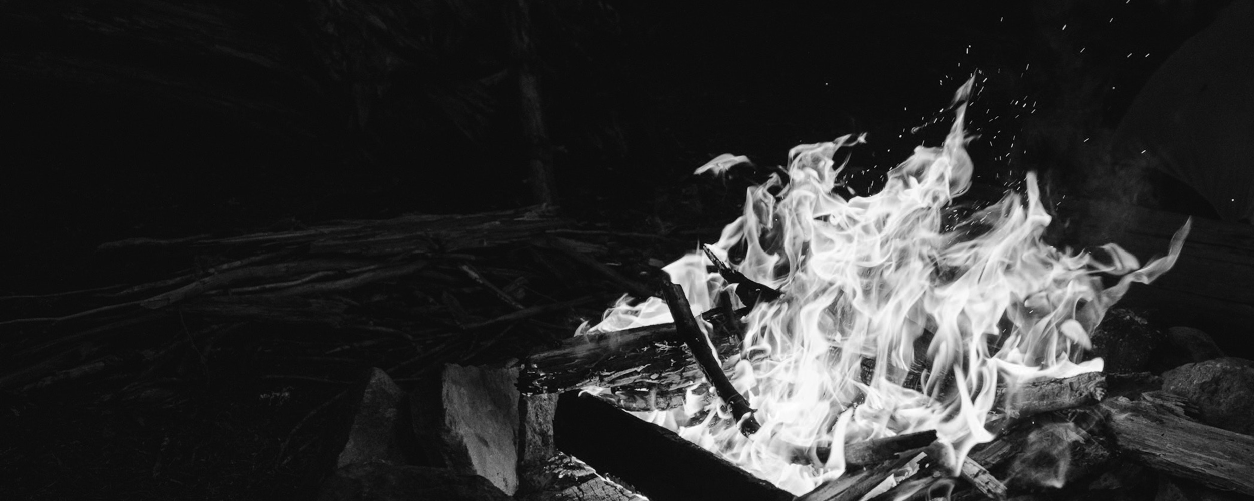
Standing on the Western edge of the Greenland Ice Sheet I watched as the first rays of morning sunlight turned the ice fall from the cold blue of the polar night to a soft warm pink. Far below us I could hear the rumblings of a glacial river, it’s origins deep in the belly of the ice sheet, thundering it’s way towards the coastal mountains and the sea. It was here that the idea for our Iceland expedition was born.
We were searching for an expedition that we could do together. Three good mates, mountaineers and adventurers that had climbed, paddled, skied all over the world, always with others, never all together. The discussion turned to Iceland with it’s mist shrouded peaks, vast glaciers, black desolate interior and mighty rivers. As with all good expeditions, it started with a couple of pints of beer and a map – soon we had the makings of an original expedition that would include everything from mountaineering to packrafting with the potential to test each of us to our absolute limit.
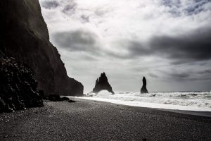
Image credit: Jen King @jenmareephotography
———————————————————
Our journey will start on the beach on the South Coast of Iceland. Before us lies 298km of climbing, skiing, hauling and paddling with 40kg of gear each to survive for 3 weeks. We have set ourselves a formidable challenge.
With our backs to the North Atlantic Ocean we plan to paddle our packrafts across the Jokulsarlon lagoon, choked with icebergs that cleave from the Breidamerkurjokull glacier as it flows towards the sea. The aim then is to stow our rafts, heave on our packs and pass under the Esjufjoll mountains that stand sentinel to the vast ice sheet of the Vatnajokull glacier. This arduous and technically challenging section of the route will take us three days, then we can strap on our skis, load our sleds and head North across deep snow and crevasses into the heart of the Vatnajokull and toward the source of the Skjalfandafljot River.
The Vatnajokull, meaning ‘water glacier’ in Icelandic, is the largest glacier in Iceland and the second largest in Europe. It covers an area of 8000 square kilometres, hiding vast valley systems and active volcanoes beneath it’s icy cloak. If Freyr blesses us with fair weather we hope to cross the Vatnajokull in seven days. This 120km section of the journey will take us to the East of the Grimsvotn volcano, then skirting Skaftarkatlar (the skafta cauldrons), two 2km subglacial lakes in the Western Vatnajokull, we will descend the Koldukvislarjokull glacial tongue and begin our search for the source of the Skjalfandafljot River.
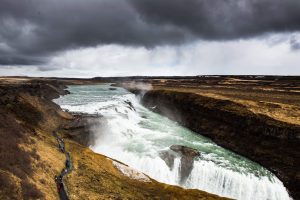
Image credit: Jen King @jenmareephotography
They say that one cannot know a river until one has seen it at it’s source. To know it’s character, it’s temperament, it’s personality. It is with great excitement and trepidation that we begin the search for the source of the river and enter the unknown. Glacial streams and river systems dominate the landscape in this area of the Icelandic Highlands and it poses a significant navigational challenge to ensure we find the right river. We have spent hours studying maps, zooming in on Google Earth and gathering as much local knowledge as possible about this little-explored area to make sure we are successful but in this dynamic, constantly changing environment the source is still going to be hard to find.
Once on the river we plan to packraft it to the sea. To our knowledge this river has never been packrafted from the source to the sea. Nor has it been paddled as part of an unsupported expedition across Iceland. The first documented descent was by a kayaking team from Sheffield University in 1989, but apart from a brief expedition account there is little information about the river.
The Skjalfandafljot is Iceland’s fourth largest river, a cauldron of ice and snow melt. From it’s source on the Northwestern edge of the Vatnajokull glacier it carves a path northward through the vast black plains of the central highlands to Skalfandi Bay and the North Atlantic. The river is characterised by rapids and waterfalls, some of which are among Iceland’s most famous. As we launch our rafts into the upper reaches of the river we again enter unknown territory and it will take all our paddling skills to stay safe. We have estimated that it will take 10 days to navigate the 178km of river, scouting large sections and avoiding the deep whitewater canyons and hidden waterfalls. As we make our descent to the sea we hope to document the course of the river with photo, film and written descriptions for expeditions and paddlers that will come after us.
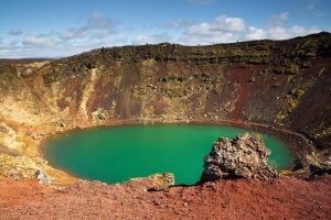
Image credit: Jen King @jenmareephotography
Dan, Rich and I make up our team of three. Rich is my brother-in-law and all round solid outdoorsman. Formerly from the North of England he’s been living in New Zealand long enough now to have adopted the classic Kiwi trait of being excellent in the mountains. We skied to the North Pole together a few years ago, and not knowing each other too well at the time I figured that if he could put up with my sister, he could probably last 6 weeks in a tent with me.
Dan and I started our adventuring careers together. We met on our first day of medical school and have been fast friends ever since. We ran together in The North Face 100, a 100km run in the Blue Mountains, NSW and then across the Atacama Desert in Chile before taking slightly different paths, Dan to the Himalayas and me to the Poles.
This will be our first expedition together as a team and I couldn’t ask for better companions.
Preparing both physically and mentally for an expedition as formidable as this requires careful planning and specific programming. I have worked with Joe Bonington at Joe’s Basecamp for a number of years and he has trained me for two previous polar expeditions. It is a complex problem having to be strong enough to carry 40kgs on your back while being endurance fit enough to cover big distances walking, skiing and paddling. Under Joe’s watchful eye and the expert programming of Chris Woolley we’ve been running, swimming, carrying packs, pulling sleds, climbing ropes, Olympic lifting and jumping in ice baths to get us ready. The guys at Joe’s Basecamp work on the principle that the fitter you are the more likely you are to be safe and successful out in the wilds. It’s comforting to know that we don’t have to worry about our fitness, the training is done and we are ready. A huge thanks to Joe and Chris, they have been outstanding.
There are only three weeks to go now until our first paddle strokes across the Jokulsarlon lagoon. It has already been quite a journey just to reach this point, 18 months of planning and training and finally we feel like we are ready. Individually we have each come a long way, we are better paddlers, better mountaineers, better friends and companions than we were at the start because of our efforts just to get to the start line.
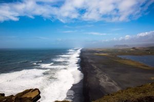
Image credit: Jen King @jenmareephotography
Gareth Andrews
Anaesthetist, Polar explorer and Joe’s Basecamp Ambassador
To follow Gareth’s journey, keep up to date at www.icelandtraverse2019.com or via his social channels:
Facebook – https://www.facebook.com/gareth.andrews.16/
Instagram – @garethandrews_15
No Comments